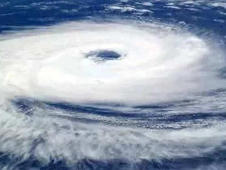
Cyclone Mocha is all set to mark the cyclone season this year, developing in Bay of Bengal.
According to the Indian Meteorological Department (IMD), a storm is gaining strength in the southeast Bay of Bengal and is predicted to develop into a cyclone by Wednesday. The IMD stated that Cyclone Mocha is likely to become a very severe storm by Friday, May 12, with wind speeds potentially reaching 130 kmph.

According to the Indian Meteorological Department (IMD), a storm is gaining strength in the southeast Bay of Bengal and is predicted to develop into a cyclone by Wednesday. The IMD stated that Cyclone Mocha is likely to become a very severe storm by Friday, May 12, with wind speeds potentially reaching 130 kmph.
Initially identified as a well-marked low-pressure area, the weather system transformed into a depression on Tuesday evening, with winds ranging from 45 to 55 kmph and gusts up to 65 kmph over the south-east Bay of Bengal. The IMD forecasts that the depression will intensify into a deep depression and subsequently evolve into Cyclone Mocha within the next 12 hours. The cyclone is expected to bring winds of 80-90 kmph, gusting to 100 kmph.
The trajectory of the system is anticipated to initially move in a north-northwest direction until the morning of May 12, and subsequently head towards the coasts of Bangladesh and Myanmar, as reported by the weather office.
The meteorological department updated, “The deep depression over southeast Bay of Bengal moved northwestwards with a speed of 07 kmph during past 06 hours and lay centered at 0830 hours IST of today, the 10th May 2023 over the same region near latitude 8.8°N and longitude 88.9°E, about 530 km southwest of Port Blair, 1430 km souds of Cox's Bazar (Bangladesh) and 1320 km south-southwest of Sittwe (Myanmar).”
What is Cyclone Mocha?
The cyclone currently referred to as Cyclone Mocha (Mokha) derived its name from the suggestion of Yemen. It was named after the historic port city of Mocha, situated on the Red Sea coast. Mocha is renowned for its significant role in introducing coffee to the world more than 500 years ago.
As per the recent update from the Indian Meteorological Department (IMD), Cyclone Mocha is gradually intensifying over the Bay of Bengal and is expected to reach the status of a very severe storm by May 12.
The IMD reports the formation of a low-pressure area in the South Andaman Sea and Southeast Bay of Bengal. This development has raised concerns among the eastern states, including West Bengal, the Andaman Islands, and Odisha, prompting them to be on high alert.
Cyclone Mocha is set to mark the onset of the cyclone season in India this year. India experiences two cyclone seasons, namely the pre-monsoon season spanning from April to June and the post-monsoon season from October to December. Among these, May and November are particularly known for their cyclone activity.
It is worth noting that during the same time last year, the region witnessed the impact of severe cyclone Asani, which approached the coast of Andhra Pradesh. The cyclone brought substantial rainfall and strong gusts of wind to the area.
Some of the recent cyclones that India in 2021-22
Cyclone Yaas,( May 2021),a highly destructive cyclone, inflicted significant damage upon the states of Odisha and West Bengal. Its ferocity wreaked havoc in Odisha before later making a substantial impact on West Bengal.
Cyclone Shaheen (January 2022): Cyclone Shaheen formed in the Arabian Sea and affected the western coast of India in January 2022. It caused heavy rainfall and strong winds in the coastal areas of Gujarat and Maharashtra.
Cyclone Gulab (September 2021): Cyclone Gulab made landfall on the eastern coast of India in September 2021. It affected parts of Odisha, Andhra Pradesh, and Telangana. The cyclone caused heavy rainfall and strong winds, resulting in localized flooding and damage to infrastructure.
Cyclone Jawad (December 2021): Cyclone Jawad formed in the Bay of Bengal and made landfall in the Andhra Pradesh-Odisha border region in December 2021. It caused heavy rainfall and strong winds in the affected areas.
Here are some guidelines to follow if you find yourself caught in a cyclone:
- Evacuate early: Leave the area before roads and pathways become flooded. Do not delay and risk being stranded.
- Seek higher ground or shelter: If your house is securely built on elevated ground, take shelter in the safe part of your house.
- Secure your property: Board up glass windows or install storm shutters. Reinforce outside doors to provide strong support.
- Stock up on essentials: Gather extra food that can be eaten without cooking. Store drinking water in covered containers.
- Safeguard valuables: If you have to evacuate, move valuable items to upper floors to minimize flood damage.
- Prepare emergency lighting: Ensure your hurricane lanterns, torches, or other emergency lights are in working condition and keep them easily accessible.
- Accommodate special needs: Make arrangements for individuals with special dietary requirements, including children and adults.


